A powerful late-season winter storm is creating dangerous weather conditions across parts of the western United States, with heavy snow and destructive winds impacting several states through the weekend. Forecasters have issued snow warnings for mountainous areas of Montana and Washington, while high wind alerts stretch across Montana, Oregon, Washington, Utah, Nevada, and Idaho.
The unusual mid-May weather system is expected to bring accumulating snow, reduced visibility, hazardous travel conditions, and possible power outages. Meteorologists say the combination of cold air and abundant Pacific moisture is allowing winter-like conditions to return to higher elevations even as much of the country experiences spring weather.
Heavy Snow Threat Expands Across Montana and Washington
Mountain communities and popular travel corridors are expected to experience the worst conditions as snow intensifies through Saturday and Sunday.
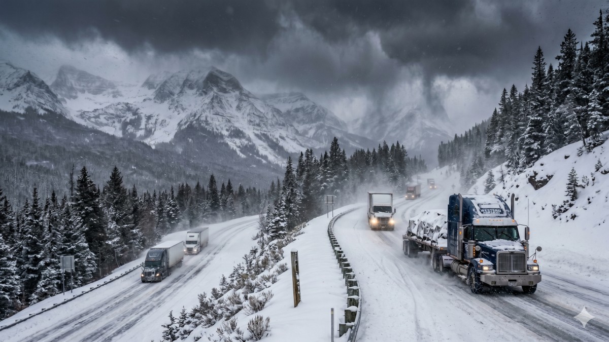
In Montana, the National Weather Service has warned that several mountain regions could receive between 3 and 7 inches of snowfall, especially at higher elevations. Areas under the snow warning include the Gallatin and Madison County Mountains, Centennial Mountains, Glacier National Park, and the Bitterroot and Sapphire Mountains.
Forecasters say snowfall will begin Saturday evening and continue into Sunday, with the heaviest accumulations expected above 5,000 feet. Glacier National Park could receive between 2 and 6 inches of snow, creating dangerous conditions for hikers, campers, and travelers.
Strong winds accompanying the storm are expected to gust up to 40 mph in some locations, significantly reducing visibility and creating difficult driving conditions across mountain passes.
Several major travel routes are expected to become especially dangerous, including:
- Targhee Pass
- Raynolds Pass
- Marias Pass
- Homestake Pass
- MacDonald Pass
Transportation officials are warning drivers to prepare for slushy and slick roads, sudden visibility drops, and rapidly changing weather conditions. Travelers towing trailers or driving larger vehicles may experience additional difficulties due to crosswinds and snow-covered roads.
Backcountry recreation also poses serious risks during the storm. Officials warn that cold, wet conditions combined with gusty winds could increase the threat of hypothermia for hikers and outdoor enthusiasts unprepared for winter-like weather.
Related Climate News
Scientists are warning that a potentially historic Super El Niño could develop in 2026, bringing extreme heatwaves, floods, droughts, hurricanes, and global weather disruptions. NOAA says ocean temperatures are rising faster than expected, increasing the risk of one of the strongest El Niño events ever recorded.
Read Full ReportWashington Mountains Preparing for Heavy Snow
Washington state is also facing dangerous mountain weather as snow showers intensify across the Cascades and Olympic Mountains.
Weather advisories remain in effect through early Sunday for elevations above 4,000 feet. Forecasters predict widespread snowfall totals of 4 to 6 inches, although higher peaks could see even greater accumulations.
The heaviest snow is expected from Friday night into Saturday, particularly around:
- Stevens Pass
- Snoqualmie Pass
- Higher elevations of the Cascades
- Olympic Mountain regions
Meteorologists say the storm may also produce isolated lightning strikes and small hail, adding to the rapidly changing mountain weather conditions.
During heavier snow bursts, roads could temporarily become snow-covered, creating sudden travel hazards for motorists crossing mountain highways. Drivers are being advised to carry winter supplies, check road conditions before traveling, and avoid unnecessary mountain trips during the worst of the storm.
Outdoor recreation areas may also become dangerous due to rapidly changing temperatures, slick trails, and reduced visibility.
Despite the timing in mid-May, forecasters note that late-season snowfall is relatively common in the higher elevations of the western United States. Cold air moving southward from Canada combined with moisture from the Pacific Ocean is fueling this unusual spring snowstorm.
Conditions are expected to gradually improve by late Sunday as temperatures slowly rise and the storm system weakens.
Destructive High Winds Threaten Multiple Western States
In addition to heavy mountain snow, several western states are facing potentially damaging wind events capable of disrupting travel and causing power outages.
Montana faces some of the strongest wind threats, with sustained winds forecast between 40 and 50 mph and gusts reaching as high as 90 mph from Wednesday evening through Thursday night.
Meteorologists warn that such extreme gusts could create life-threatening travel conditions for high-profile vehicles such as trucks, RVs, and trailers. Power outages are also likely due to falling trees and damaged power lines.
Dry conditions combined with powerful winds may also increase wildfire spread risks in vulnerable areas.
Oregon and Washington Under Wind Alerts
Parts of Oregon are also under high wind warnings, especially in the northern and southern Blue Mountain foothills near Pendleton, Fossil, Pilot Rock, and Heppner.
Winds in these areas are expected to range from 30 to 40 mph, with gusts potentially reaching 65 mph. Residents are being warned about falling trees, flying debris, and scattered power outages.
In neighboring Washington, strong winds are forecast around Pomeroy, Anatone, and Clarkston.
Wind speeds there could reach 25 to 35 mph, with gusts between 45 and 65 mph, especially at elevations above 2,000 feet. Officials say difficult driving conditions and falling tree limbs are among the primary concerns.
Utah and Nevada Facing Dangerous Travel Conditions
Utah’s Great Salt Lake Desert region, including Wendover and Dugway, is also under a high wind warning.
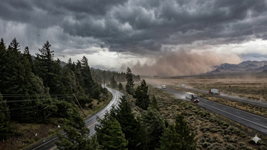
Forecasters expect sustained winds between 30 and 40 mph with gusts up to 60 mph. Interstate 80 could become particularly dangerous for drivers due to powerful crosswinds and blowing dust.
In southeastern Elko County, Nevada, wind gusts may also reach 60 mph. Blowing dust is expected to reduce visibility to less than half a mile in some locations, creating hazardous travel conditions for motorists.
Understanding the Difference Between Wind Advisories and High Wind Warnings
Weather officials remind residents that a Wind Advisory is issued when sustained winds range from 30 to 39 mph or gusts reach between 45 and 57 mph. These conditions can cause minor property damage and difficult travel.
A High Wind Warning, however, signals far more dangerous conditions. These warnings are issued when sustained winds exceed 40 mph or gusts surpass 58 mph. Such events can lead to major travel disruptions, structural damage, downed power lines, and widespread outages.
Officials Urge Residents to Stay Prepared
Emergency management agencies across the western U.S. are urging residents and travelers to monitor weather forecasts closely throughout the weekend.
People living in affected regions are encouraged to:
- Avoid unnecessary mountain travel
- Secure outdoor furniture and loose objects
- Prepare emergency kits and flashlights
- Charge electronic devices ahead of possible outages
- Carry winter supplies if traveling through mountain passes
- Monitor local road and weather updates frequently
While the storm is expected to weaken late Sunday, officials warn that conditions may remain dangerous in higher elevations until temperatures stabilize.
Disclaimer
This article is based on weather forecasts, advisories, and publicly available meteorological information at the time of writing. Weather conditions may change rapidly. Readers should follow official updates from the National Weather Service and local emergency authorities before making travel or outdoor activity decisions.


One thought on “Heavy Snow and High Wind Warnings Issued Across Western U.S. as Montana and Washington Face Dangerous Weekend Weather”