
NOAA Warns 2026 El Niño Could Become a Historic “Super El Niño”
The world may be heading toward one of the most powerful climate events in modern history. According to the latest forecast from the National Oceanic and Atmospheric Administration and its Climate Prediction Center, El Niño is developing far more rapidly than scientists originally expected, raising fears that a rare and extremely powerful “Super El Niño” could emerge by late 2026.
Forecasters now estimate there is an 82% chance that El Niño conditions will officially form between May and July 2026. Even more concerning, scientists believe there is a 96% probability the event will continue through the winter of 2026–27. Climate experts say the odds of this becoming a very strong or “Super El Niño” have risen significantly, increasing from roughly 25% earlier this year to nearly 33–37%.
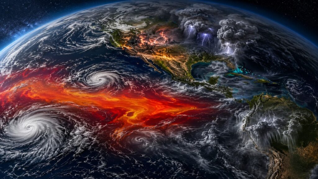
If those forecasts prove accurate, the planet could experience a dramatic rise in extreme weather events, including dangerous heatwaves, severe droughts, powerful flooding, and major shifts in hurricane activity across multiple continents.
What Is El Niño and Why Does It Matter?
El Niño is a naturally occurring climate pattern that develops when sea-surface temperatures in the central and eastern equatorial Pacific Ocean become warmer than average. Although it begins in the Pacific, its effects spread across the globe by disrupting atmospheric circulation, wind systems, and rainfall patterns.
Scientists officially declare El Niño conditions when Pacific Ocean temperatures remain at least:
above average for a sustained period.
A “Super El Niño,” however, is much more intense and is typically associated with ocean temperatures rising beyond:
above normal levels.
Some European climate models now suggest Pacific Ocean temperatures could surge close to:
above average by November 2026 — a level that would place this event among the strongest ever recorded.
Meteorologists say an enormous pool of unusually warm water currently trapped beneath the Pacific Ocean surface is expected to rise over the coming months. This process could rapidly intensify El Niño during summer and autumn, potentially pushing it into historic territory.
Could This Become the Strongest El Niño of the Century?
Climate scientists are increasingly comparing the developing 2026 event to several legendary El Niño episodes from the past, including:
- 2015–16
- 1997–98
- 1982–83
- 1972–73
These past Super El Niño events triggered catastrophic floods, devastating droughts, record-breaking global temperatures, crop failures, and billions of dollars in economic losses worldwide.
The 1997–98 El Niño alone caused widespread disasters across North and South America, Asia, Africa, and Oceania. The 2015–16 event contributed to some of the hottest global temperatures ever recorded and intensified coral bleaching in oceans around the world.
Scientists now warn the 2026 event could rival — or possibly exceed — those historic climate disruptions.
Why Forecasting El Niño Is Difficult
Despite growing confidence that El Niño is strengthening rapidly, meteorologists still caution that uncertainty remains regarding its ultimate peak intensity.
One major reason is something known as the “spring predictability barrier.” During the Northern Hemisphere spring, forecasting Pacific Ocean behavior becomes more challenging because small atmospheric changes can significantly alter how El Niño develops later in the year.
This means forecasts may still shift in the coming months. However, the consistent warming trends being observed across the Pacific have raised concern among climate experts worldwide.
Global Temperatures Could Reach New Records
One of the biggest concerns surrounding a strong El Niño is its effect on global temperatures.
El Niño events naturally transfer enormous amounts of heat from the ocean into the atmosphere. Combined with long-term human-driven climate change, this additional warming could make 2026 or 2027 the hottest year ever recorded on Earth.
Many scientists believe global heatwaves may become more severe and more frequent if a Super El Niño fully develops.
Countries across North America, Europe, and parts of Asia could face prolonged periods of extreme summer temperatures, increasing risks for:
- Wildfires
- Energy shortages
- Water stress
- Health emergencies
- Agricultural damage
Cities already struggling with climate-driven heat may see dangerous conditions worsen substantially.
Major Rainfall Shifts Expected Worldwide
El Niño dramatically alters global rainfall patterns, often creating a mix of floods and droughts in different regions simultaneously.
Regions Likely to Experience Increased Rainfall
Scientists expect wetter-than-normal conditions in several areas, including:
- Southern United States
- Parts of the Rocky Mountains
- Southwestern United States
- Horn of Africa
- Central Asia
- Sections of South America
Heavy rainfall in these regions could increase flooding risks, landslides, and infrastructure damage.
In the United States, southern states may experience wetter winters and cooler conditions later in the year due to changing atmospheric circulation patterns linked to El Niño.
Meanwhile, parts of the Mid-Atlantic and Northeastern United States are expected to see warmer-than-normal summer temperatures.
Drought Risks Growing in Several Regions
While some countries could receive excessive rainfall, others may face severe drought conditions.
Climate models suggest drier-than-average weather is likely in:
- Australia
- Indonesia
- Southern Asia
- Caribbean regions
Australia, in particular, often experiences heightened bushfire risks during major El Niño events due to reduced rainfall and hotter temperatures.
Indonesia may also see increased wildfire activity, haze pollution, and agricultural stress if dry conditions intensify later in 2026.
The Caribbean could face worsening drought concerns that threaten freshwater supplies, tourism industries, and regional agriculture.
El Niño Could Reshape Hurricane Activity
One of the most important impacts of El Niño involves tropical storms and hurricanes.
Atlantic Hurricane Season May Become Less Active
Strong El Niño events typically suppress Atlantic hurricane formation because they increase vertical wind shear across the Atlantic Ocean. Wind shear disrupts storm organization and makes it harder for hurricanes to strengthen.
As a result, forecasters expect fewer Atlantic hurricanes during the peak of El Niño conditions.
However, experts warn that “fewer” storms does not necessarily mean “safe.” Even during quieter hurricane seasons, a single major storm can still cause catastrophic destruction.
Pacific Ocean Could See More Cyclones
While Atlantic hurricane activity may decrease, the opposite often occurs in the Pacific Ocean.
Scientists expect more tropical cyclone development in the central and eastern Pacific during a strong El Niño year. Warmer ocean temperatures provide additional energy that fuels storm formation and intensification.
Countries and territories across the Pacific region could therefore face elevated cyclone risks later in 2026 and early 2027.
Economic and Environmental Consequences Could Be Massive
A Super El Niño has the potential to disrupt global economies on multiple levels.
Possible consequences include:
- Agricultural production losses
- Higher food prices
- Water shortages
- Energy demand spikes
- Shipping disruptions
- Insurance losses
- Infrastructure damage from floods and storms
Environmental impacts may also become severe.
Marine ecosystems could suffer from widespread coral bleaching as ocean temperatures rise sharply. Fisheries may also experience disruption due to changing ocean currents and marine migration patterns.
Scientists say the combination of El Niño and long-term climate warming could amplify environmental stress worldwide.
Climate Change May Be Making El Niño More Dangerous
Although El Niño is a natural climate cycle that occurs every two to seven years and usually lasts around 9–12 months, researchers increasingly believe climate change may intensify its impacts.
A warmer atmosphere can hold more moisture, which increases the likelihood of extreme rainfall events during El Niño years. At the same time, hotter baseline temperatures can worsen droughts and heatwaves in vulnerable regions.
This means future El Niño events may produce stronger and more unpredictable weather extremes than those experienced decades ago.
The developing 2026 system is already drawing close attention from meteorologists, governments, emergency agencies, and climate researchers around the world.
The World Is Closely Watching the Pacific Ocean
Over the coming months, scientists will continue monitoring Pacific Ocean temperatures, atmospheric pressure patterns, trade winds, and underwater heat content to determine whether the current forecasts continue strengthening.
If the latest projections hold true, the second half of 2026 could become a defining period for global climate conditions.
From record-breaking heatwaves in North America to intensified Pacific cyclones and widespread rainfall disruptions across multiple continents, the emerging Super El Niño may shape weather patterns for millions of people worldwide.
For now, experts say preparation and close monitoring will be critical as the Pacific Ocean continues warming at an alarming pace.
Disclaimer
This article is based on climate forecasts, scientific models, and publicly available data from meteorological agencies and research institutions. Weather and climate predictions may change as new observations become available. This content is intended for informational purposes only and should not be considered official emergency or government guidance.